


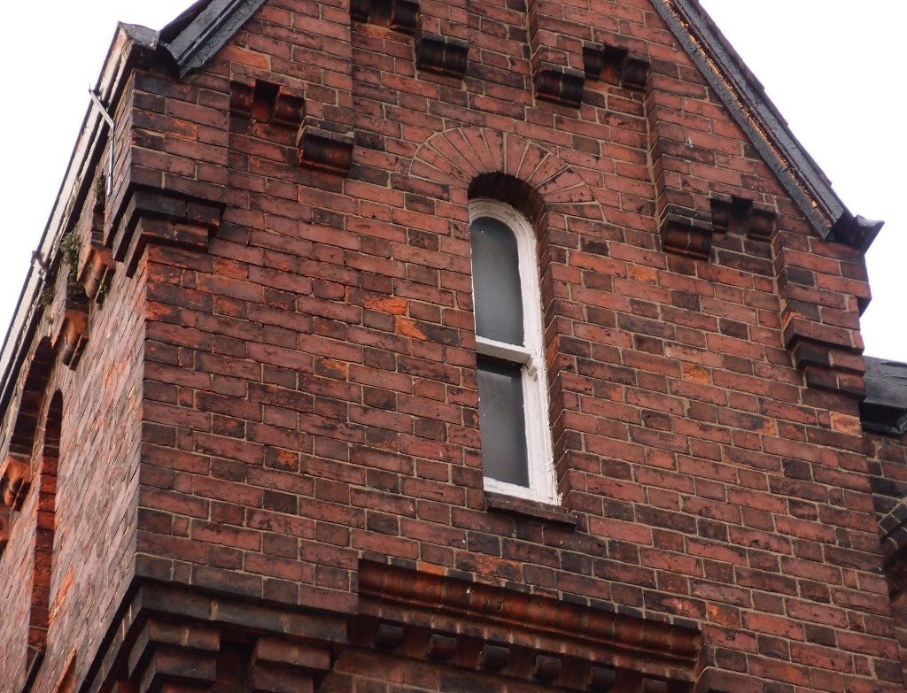
Recognise this cheeky little window? I thought we could pay it some attention as it’s on a building looking likely to be demolished.
It’s a detail on one of the buildings on the fire station site. We may be more familiar with this site from its other end, at the Clifford Street/Peckitt Street corner. This 19th century house is at the other end, near the river, and is referred to as ‘the lodge’ in some of the planning application documents.
The fire station planning application (ref 15/02155/FULM) is due to be discussed and decided at a planning committee meeting this Thursday, 12 May.
The committee report outlining the main issues is in the list of documents on this link. It recommends approval of the plans ‘subject to completion of a section 106 agreement and referral to the Secretary of State (unless Historic England withdraws its objection)’. Historic England may have withdrawn its objection since that was written. Frankly there are so many documents and versions of the proposals for this site that I couldn’t trawl through all of them.
Since I last wrote about the Clifford St/Peckitt St fire station site some months ago the plans have been changed. They now retain the frontage of the former chapel building on Peckitt Street and a former school building alongside.
This has been covered in the Press and details can also be found on the planning application pages. There are a lot of documents to wade through.
I don’t recall ever seeing before so many ‘support’ comments for an application of this type, and I don’t recall seeing so many from people commenting from far afield. I’m assuming that there has been a concerted campaign to encourage support of the plans to redevelop the site, and it looks like it has been effective.
Those of us who have had concerns about the existing buildings on the site have tended to focus on the views of the prominent corner, Clifford Street and Peckitt Street, and particularly the chapel building frontage on Peckitt Street. The lodge building on the other corner is also prominent and aesthetically pleasing, but the fact that it’s at the riverside end of the site has effectively sealed its fate, it would seem.
This photo may give a better idea of the context.
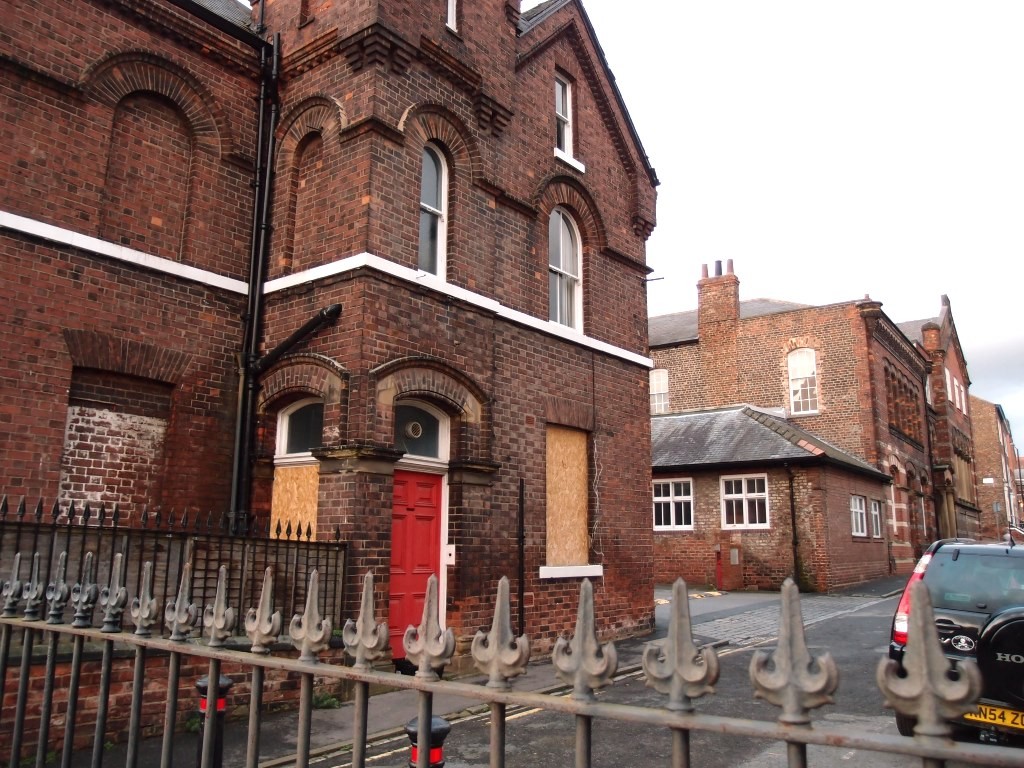
When I took the photo above I was standing at the bottom of Peckitt Street, on the top of the steps down to the riverside walkway. The lodge building is in the foreground and the former chapel building can be seen further up the street.
And here’s a view of the lodge building from the riverside walkway.
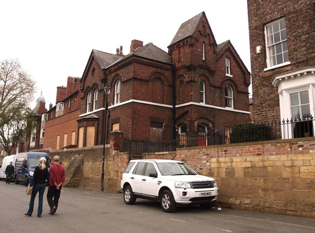
Despite its nice architectural details it could be said that it’s nothing special. It could also be said that it’s got more character and interest than what is proposed in its place. That’s a matter of opinion. And whatever opinion we’re of it seems that it won’t matter, as it looks likely to be demolished.
The main problem for the lodge building is the flood risk. Highlighted by this photo, taken from the steps nearby, just before Christmas last year.
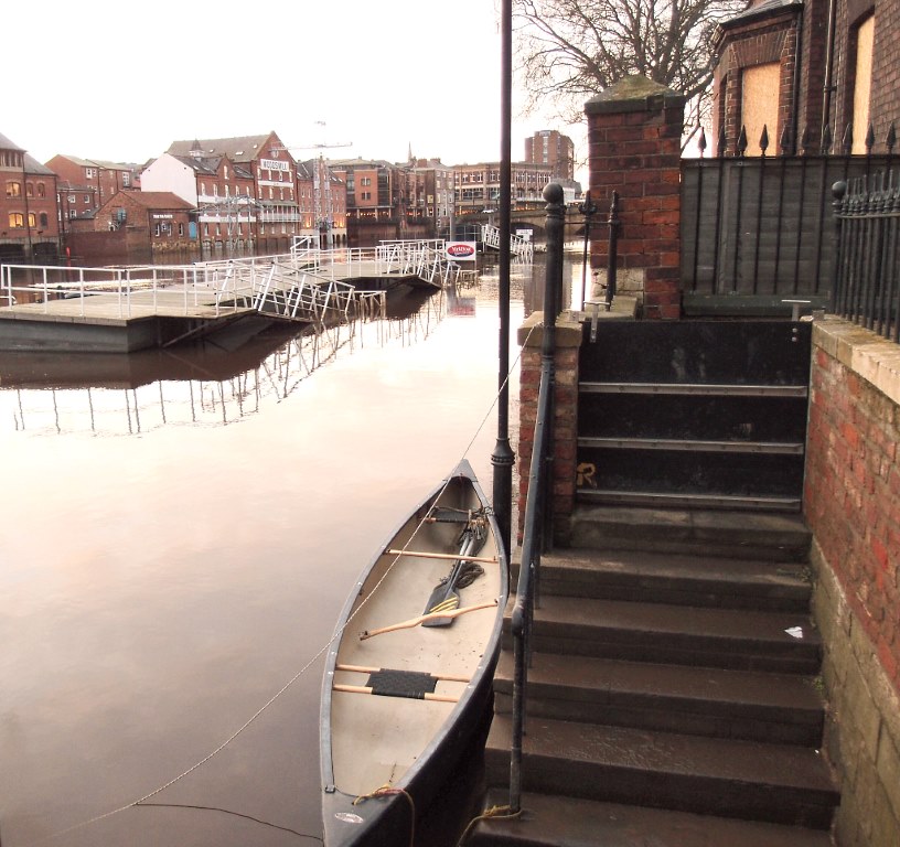
The lodge (with its boarded-up windows) is on the right. The boat is on an area which is normally dry land. The Ouse, when not in flood, is behind the wooden platform with railings around it.
The devastating flooding of Foss-side properties happened not long after this photo was taken, just after Christmas. Here, Ouse-side, the effects weren’t as devastating because floods are expected as a regular occurrence. However, the risk seems to mean that this building won’t be retained in the planned redevelopment of the site.
In the documents relating to the planning application conservation architect Janine Riley states that ‘a clear and convincing justification has been provided for its demolition’, and continues:
Due to the flood conditions it would be impossible to reuse the building without tanking the ground floor and also providing an escape route above the flood level for residential use. Tanking would need to be inside the building to hide its unsightly effects and to prevent damage to archaeology. Whilst this has been achieved at Bonding Warehouse it would be economically unviable at the “lodge” where only one floor and the attic could be occupied, and the ground floor interior would be seriously damaged. Even so civil engineering assessments have concluded that a tanked building would still represent a weak spot in the flood protection of the site as a whole. The justification for demolition appears to be robust.
Though other comments, including one from the owner of a neighbouring property, point out that other buildings on this riverside frontage manage to cope with repeated flooding. Or as the Victorian Society’s response (also on this link) puts it:
… the Society maintains its objection to the demolition of the ‘lodge’. We have pointed out previously what is now acknowledged by all, that the lodge is an attractive and characterful building and one that makes a positive contribution to the special interest of the Conservation Area. Its loss would therefore be detrimental to the significance of the Conservation Area and it would also harm the setting of adjacent listed buildings and structures. Despite the additional information that has been submitted in support of its proposed demolition we remain unconvinced that the lodge could not relatively simply be retained. We recognise the problems posed by flooding. However, this is an issue that every property on the river contends with, including numerous eighteenth and nineteenth-century properties in the immediate vicinity of the lodge.
There are other issues discussed in the planning application documents, including the below-ground impact, on the site’s archaeology. I can’t cover all of that here. Comments welcome below.
More information
The 12 May planning meeting will, I imagine, be webcast — visit www.york.gov.uk/webcasts from 4.30pm on Thursday to watch it live, or view it later on the council’s YouTube channel.
There’s more information about the meeting on this link (see item 4f).
For ‘before and after’ views of all the buildings on the site from all angles see the ‘CGI images’ (dated 16 March 2016) in this list of documents, or try loading the PDF on this link (may or may not work, the planning access system sometimes delivers PDFs and sometimes doesn’t).
I cant believe how many of York’s beautiful old buildings are being lost, it’s too sad, we’ll never see quality and attention to detail like thus again